A regular occurrence during the holiday season off the Northumberland coast is the rescue of visitors heading along the causeway to the Holy Island of Lindisfarne.
Within a few days last month, two different families were plucked to safety by teams from the RNLI and Coastguard Rescue as their vehicles were consumed by the incoming tide.
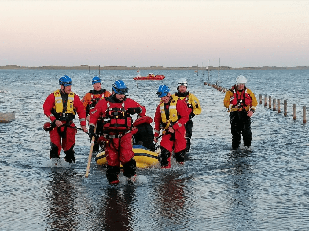
Despite repeated warnings to check the tide tables, Northumberland County Council estimate that between 10 and 20 vehicles are stranded each year, putting the lives of both rescuers and the rescued at risk.
News headlines created by these recent incidents reminded me of a photograph taken nearly a century ago titled ‘Road to Holy Island.’
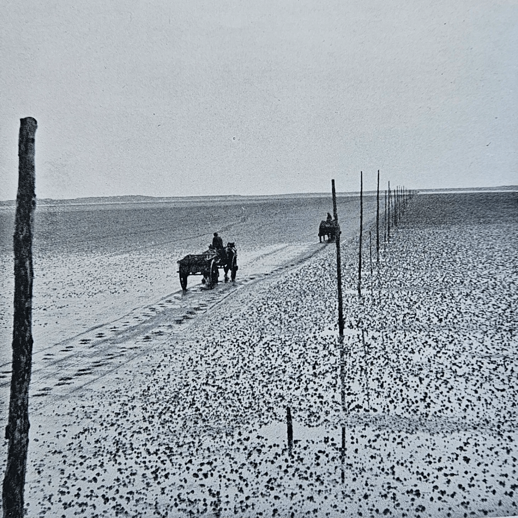
A wonderfully evocative image, it was taken by Lancashire-born J.R. Bainbridge (1891-1967).
Known as Roland, he took up freelance journalism and photography during the economic slump of the 1920s by which time he had relocated to Belfast in Northern Ireland.
Like a number of photographers, he responded to a call for images to illustrate Northumberland and Durham: A Shell Guide published in 1937.
The idea of publishing a series of county guides aimed at holidaying motorists was inspired by John Betjeman, the celebrated architectural writer and later Poet Laureate.
With Betjeman as editor, the series sponsored by Shell Petroleum launched in 1934 with Cornwall followed in quick succession by Kent, Wiltshire, Derbyshire, Devon, Dorset, Buckinghamshire, Somerset and Oxfordshire.
For Northumberland & Durham, Betjeman signed-up County Durham-born Thomas Sharp (1901-1978) whose writings about the changing face of Britain were attracting national attention.
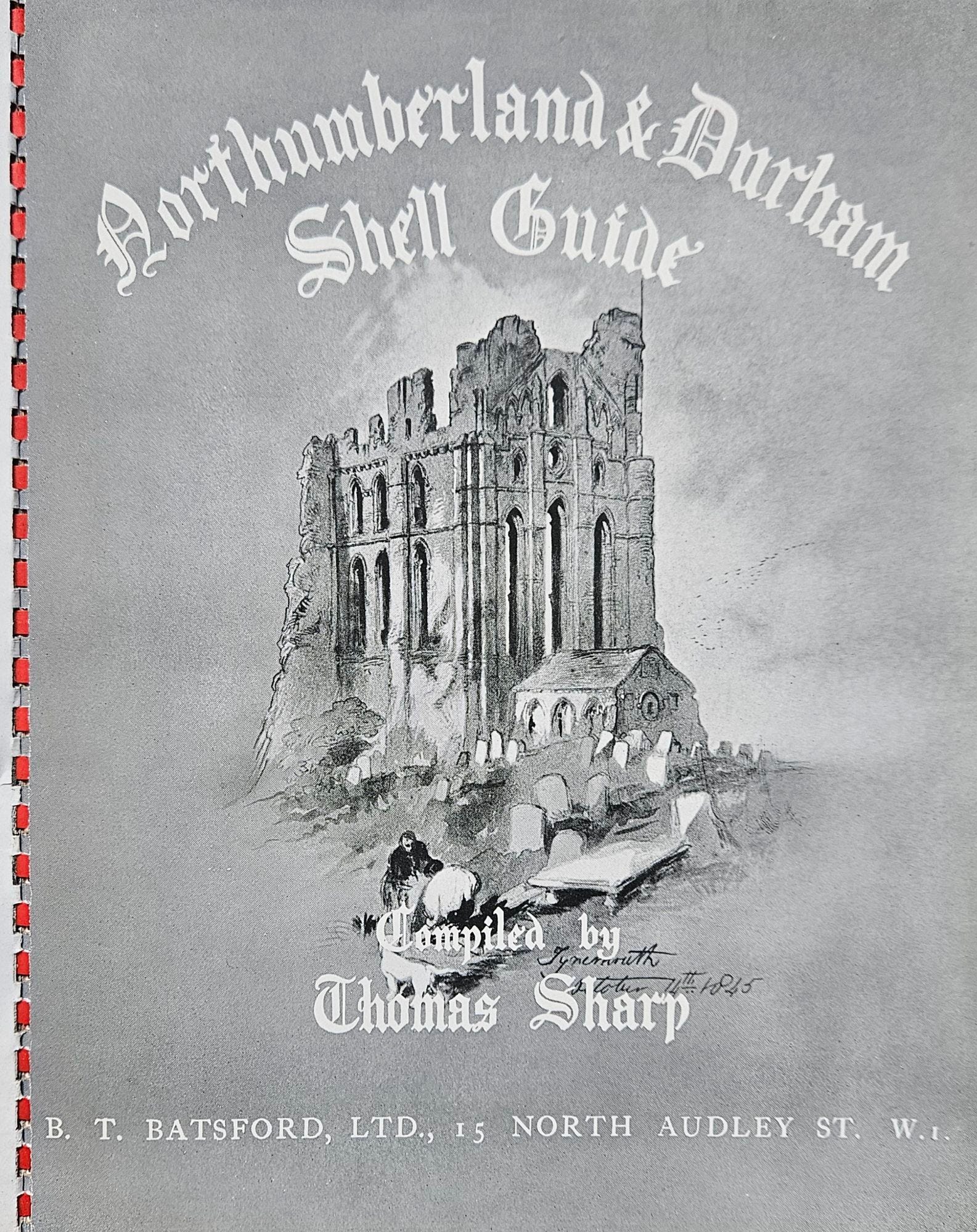
The guide that Sharp compiled was published with an eye-catching cover featuring a Farne Islands puffin with a painting of Tynemouth Priory on its title page.
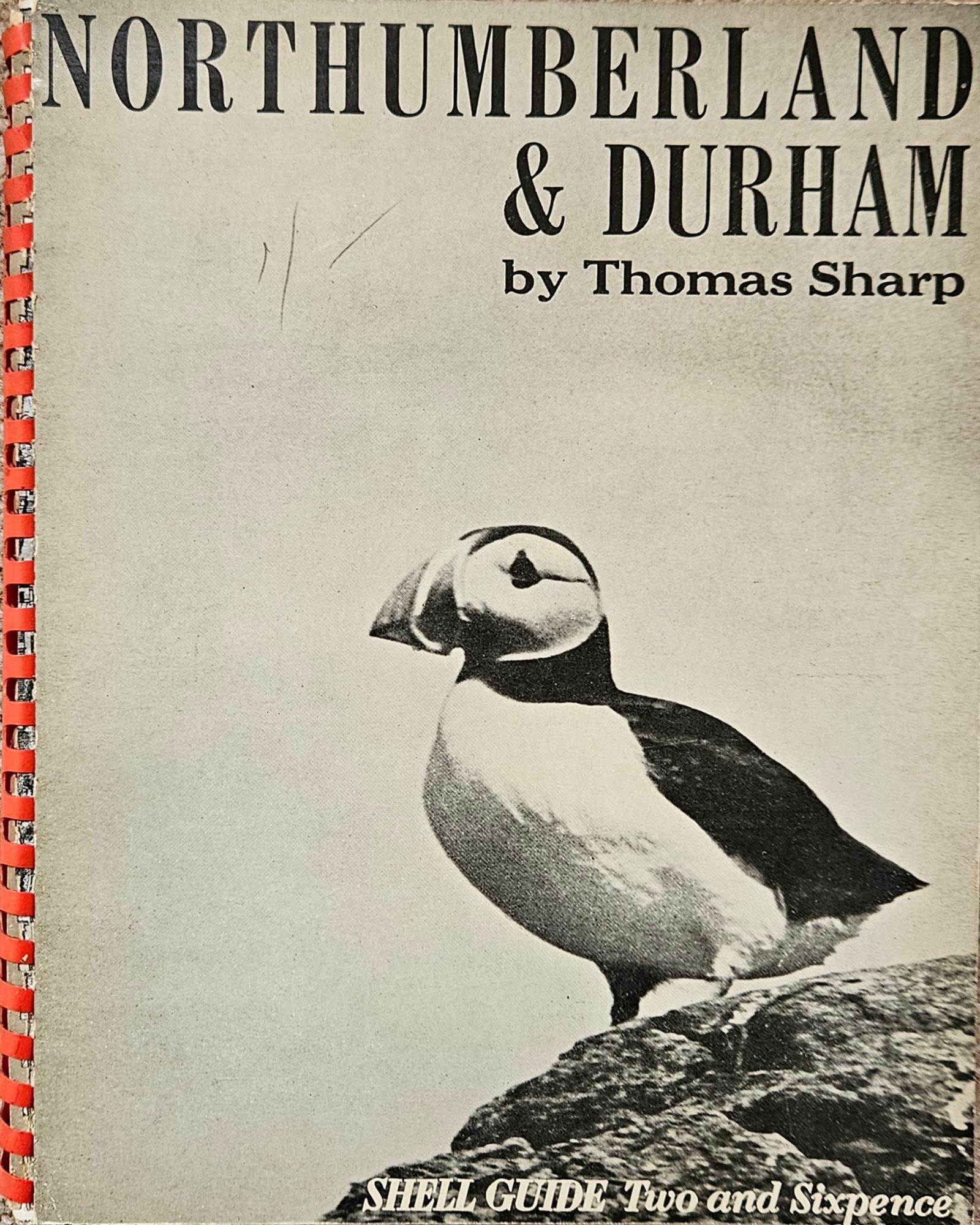
The guide’s design was more problematic as it employed a ring-bound spine in red plastic, which means that few copies have survived intact.
Alongside line drawings and reproductions of works by legendary Northumberland wood engraver Thomas Bewick (1753-1828), nearly 50 photographs were chosen to illustrate the guide.
In addition to ‘Road to Holy Island’, JR Bainbridge was credited with a second image titled ‘Roman Wall’.
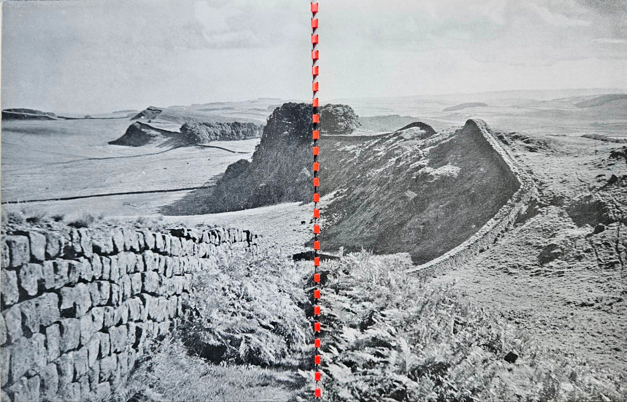
Despite being presented across two pages with the red ring binding cutting it in half, this stretch of Hadrian’s Wall is immediately recognisable.
It will also be familiar to those who know Dan Jackson’s The Northumbrians (London: Hurst, 2019).
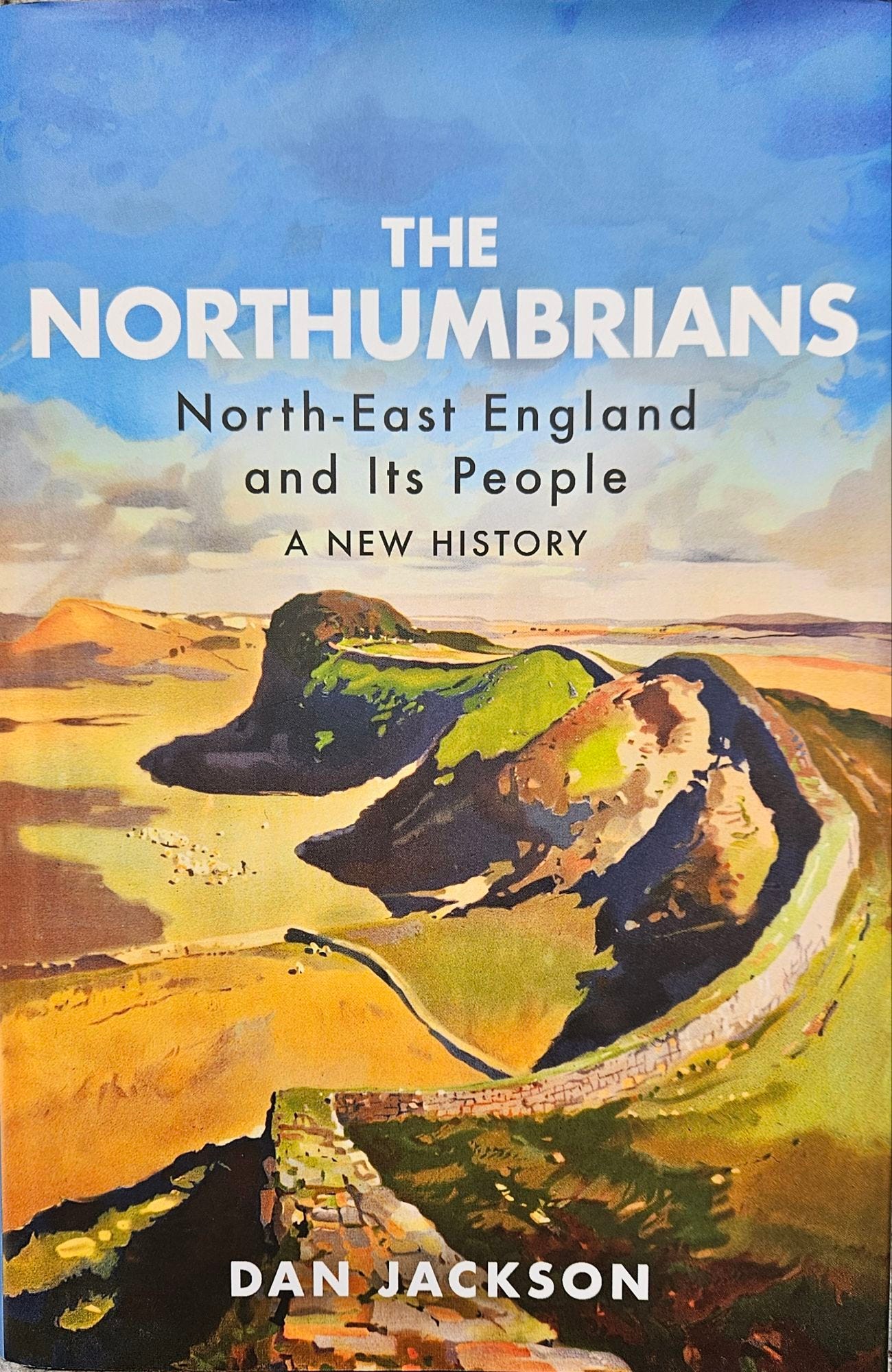
The book’s cover features the same location as portrayed in a British Railways poster by the artist and illustrator Jack Merriott (1901-1968) that was created around the same time as Bainbridge’s photograph.
Today, J.R. Bainbridge is best-known to historians and researchers for his photographs taken in Ulster during the Second World War.
However, his two contributions to Northumberland & Durham: A Shell Guide were considered of sufficient quality to appear nearly twenty years later when a Shell Guide devoted solely to Northumberland was published.

Leave a comment